Remote sensing for improved climate reporting (KlimaFern)

Objective
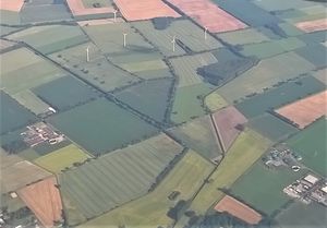
Comprehensive coverage of agricultural use with satellite data to improve the data basis for climate reporting for the LULUCF sector (land use, land use change, forestry)
Methodology
- Development of instruments for the area-wide collection and evaluation of activity data based on temporally and spatially high-resolution satellite data of different systems (optical and radar)
- Generating a data basis for monitoring of measures in the LULUCF sub-sector "agricultural land use" (a) for humus conservation in arable land, (b) for conservation of permanent grassland as well as (c) of soil carbon content in arable land
- Calculation of indicators from the satellite data, which are used not only for climate change monitoring, but also to characterise other ecosystem services provided by agriculture
Climate effect under consideration
Improved estimation of the scope and development of activity data (including GHG mitigation measures) in agricultural land use
Publications
Broeg T, Don A., Scholten T., Erasmi S. (2026): Reducing Bias in Cropland Soil Organic Carbon and Clay Predictions using Sentinel-2 Composites and Data Balancing. Remote Sensing of Environment, doi.org/10.1016/j.rse.2025.115109
Lobert F, Schwieder M, Hostert P, Gocht A, Erasmi S (2025): Characterizing spatio-temporal patterns of winter cropland cover in Germany based on Landsat and Sentinel-2 time series. International Journal of Applied Earth Observation and Geoinformation 142, 104728. doi.org/10.1016/j.jag.2025.104728
Lobert, F, Schwieder, M, Alsleben, J, Broeg, T, Kowalski, K, Okunjeni, A, Hostert, P, Erasmi, S (2025): Unveiling Year-Round Cropland Cover by Soil-Specific Spectral Unmixing of Landsat and Sentinel-2 Time Series. Remote Sensing of Environment, 318, 114594. https://doi.org/10.1016/j.rse.2024.114594
Muro J, Blickensdörfer L, Don A, Köber A, Asam S, Schwieder M, Erasmi S (2025): Hedgerow mapping with high resolution satellite imagery to support policy initiatives at national level. Remote Sensing of Environment, 328, 114870. https://doi.org/10.1016/j.rse.2025.114870
Brög, T, Don, A, Gocht, A, Scholten, T, Taghizadeh-Mehrjardi, R, & Erasmi, S (2024): Using local ensemble models and Landsat bare soil composites for large-scale soil organic carbon maps in cropland. Geoderma, 444, 116850. https://doi.org/10.1016/j.geoderma.2024.116850
Brög, T, Don, A, Wiesmeier, M, Scholten, T, Erasmi, S (2024): Spatiotemporal monitoring of cropland soil organic carbon changes from space. Global Change Biology. https://doi.org/10.1111/gcb.17608
Pham, V-D, Tetteh, G, Thiel, F, Erasmi, S, Schwieder, M, Frantz, D, van der Linden, S (2024): Temporally transferable crop mapping with temporal encoding and deep learning augmenta-tions. International Journal of Applied Earth Observation and Geoinformation 129, 103867. https://doi.org/10.1016/j.jag.2024.103867
Brög, T, Don, A, Gocht, A, Scholten, T, Taghizadeh-Mehrjardi, R, Erasmi, S (2023): Using Local Ensemble Models and Landsat Bare Soil Composites for Large-Scale Soil Organic Carbon Maps. Preprint, available at SSRN: http://dx.doi.org/10.2139/ssrn.4594434
Data sets and products
Broeg T, Don A, Scholten T, Erasmi S (2025): High-Resolution Maps (10 m) of Cropland Soil Organic Carbon and Clay in Germany based on Sentinel-2 Data. Zenodo, https://doi.org/10.5281/zenodo.15403341
Muro J, Blickensdörfer L, Köber A, Schwieder M, Don A, Erasmi S (2025): Spatially explicit distribution of hedgerows across German agricultural landscapes. Zenodo, https://doi.org/10.5281/zenodo.16895299
Tetteh G, Schwieder M, Blickensdörfer, L, Gocht A, Erasmi S (2025): Agricultural land use (raster): National-scale crop type maps for Germany from combined time series of Sentinel-2 and Landsat data (2025). Zenodo, https://doi.org/10.5281/zenodo.17197871
Tetteh G, Schwieder M, Blickensdörfer L, Gocht A, Erasmi S. (2025): Agricultural land use (raster): National-scale crop type maps for Germany from combined time series of Sentinel-2 and Landsat data (2024). Zenodo, https://doi.org/10.5281/zenodo.17190438
Contact persons
Thünen Institute, Institute of Farm Economics
Link to project page: KlimaFern


