Fernerkundung für eine Verbesserung der Klimaberichterstattung (KlimaFern)
Zielsetzung
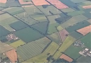
Flächendeckende Erfassung der landwirtschaftlichen Nutzung mit Satellitendaten zur Verbesserung der Datengrundlage zur Klimaberichterstattung für den LULUCF-Sektor (Landnutzung, Landnutzungsänderung, Forst)
Methodik
- Entwicklung von Instrumenten zur flächendeckenden Erfassung und Evaluierung von Aktivitätsdaten auf Basis von zeitlich und räumlich hochauflösenden Satellitendaten unterschiedlicher Systeme (optisch und Radar)
- Generierung einer Datengrundlage für das Monitoring von Maßnahmen im LULUCF-Teilsektor „landwirtschaftliche Flächennutzung“ (a) zum Humuserhalt in Ackerland, (b) zum Erhalt von Dauergrünland sowie (c) des Bodenkohlenstoff-Gehalts im Ackerland
- Berechnung von Indikatoren aus den Satellitendaten, die nicht nur für die Monitoring-Ziele im Bereich des Klimaschutzes genutzt werden, sondern auch zur Charakterisierung anderer Ökosystemleistungen der Landwirtschaft
Betrachteter Klimaeffekt
Verbesserte Abschätzung von Umfang und Entwicklung von Aktivitätsdaten (u.a. THG-Minderungsmaßnahmen) in der landwirtschaftlichen Flächennutzung
Ausgewählte Veröffentlichungen
Broeg T, Don A., Scholten T., Erasmi S. (2026): Reducing Bias in Cropland Soil Organic Carbon and Clay Predictions using Sentinel-2 Composites and Data Balancing. Remote Sensing of Environment, doi.org/10.1016/j.rse.2025.115109
Lobert F, Schwieder M, Hostert P, Gocht A, Erasmi S (2025): Characterizing spatio-temporal patterns of winter cropland cover in Germany based on Landsat and Sentinel-2 time series. International Journal of Applied Earth Observation and Geoinformation 142, 104728. doi.org/10.1016/j.jag.2025.104728
Lobert, F, Schwieder, M, Alsleben, J, Broeg, T, Kowalski, K, Okunjeni, A, Hostert, P, Erasmi, S (2025): Unveiling Year-Round Cropland Cover by Soil-Specific Spectral Unmixing of Landsat and Sentinel-2 Time Series. Remote Sensing of Environment, 318, 114594. https://doi.org/10.1016/j.rse.2024.114594
Muro J, Blickensdörfer L, Don A, Köber A, Asam S, Schwieder M, Erasmi S (2025): Hedgerow mapping with high resolution satellite imagery to support policy initiatives at national level. Remote Sensing of Environment, 328, 114870. https://doi.org/10.1016/j.rse.2025.114870
Brög, T, Don, A, Gocht, A, Scholten, T, Taghizadeh-Mehrjardi, R, & Erasmi, S (2024): Using local ensemble models and Landsat bare soil composites for large-scale soil organic carbon maps in cropland. Geoderma, 444, 116850. https://doi.org/10.1016/j.geoderma.2024.116850
Brög, T, Don, A, Wiesmeier, M, Scholten, T, Erasmi, S (2024): Spatiotemporal monitoring of cropland soil organic carbon changes from space. Global Change Biology. https://doi.org/10.1111/gcb.17608
Pham, V-D, Tetteh, G, Thiel, F, Erasmi, S, Schwieder, M, Frantz, D, van der Linden, S (2024): Temporally transferable crop map-ping with temporal encoding and deep learning augmentations. International Journal of Applied Earth Observation and Geoinformation 129, 103867. https://doi.org/10.1016/j.jag.2024.103867
Brög, T, Don, A, Gocht, A, Scholten, T, Taghizadeh-Mehrjardi, R, Erasmi, S (2023): Using Local Ensemble Models and Landsat Bare Soil Composites for Large-Scale Soil Organic Carbon Maps. Preprint, available at SSRN: http://dx.doi.org/10.2139/ssrn.4594434
Daten / Produkte
Broeg T, Don A, Scholten T, Erasmi S (2025): High-Resolution Maps (10 m) of Cropland Soil Organic Carbon and Clay in Germany based on Sentinel-2 Data. Zenodo, https://doi.org/10.5281/zenodo.15403341
Muro J, Blickensdörfer L, Köber A, Schwieder M, Don A, Erasmi S (2025): Spatially explicit distribution of hedgerows across German agricultural landscapes. Zenodo, https://doi.org/10.5281/zenodo.16895299
Tetteh G, Schwieder M, Blickensdörfer, L, Gocht A, Erasmi S (2025): Agricultural land use (raster): National-scale crop type maps for Germany from combined time series of Sentinel-2 and Landsat data (2025). Zenodo, https://doi.org/10.5281/zenodo.17197871
Tetteh G, Schwieder M, Blickensdörfer L, Gocht A, Erasmi S. (2025): Agricultural land use (raster): National-scale crop type maps for Germany from combined time series of Sentinel-2 and Landsat data (2024). Zenodo, https://doi.org/10.5281/zenodo.17190438
Ansprechpersonen
Thünen-Institut, Institut für Betriebswirtschaft
Link zur Projektseite: KlimaFern